重庆交通大学智慧城市学院师生参加第十四届国际数字地球会议
日期:2025-04-30作者:编辑:智慧城市学院审核人:何荣波浏览量:
2025年4月21-25日,第十四届国际数字地球会议在重庆市召开。本次会议由国际数字地球学会、西南大学主办。会议以“数字地球促进可持续发展目标进程”为主题,设立8场大会特邀报告、53个平行分会、470个专题学术报告,涵盖“数字可持续发展国际科学计划(DSP)”“地球大数据平台建设”“数字地球应用实践”以及“一带一路”数字科技合作等多个研究方向。会议吸引了来自全球近30个国家和地区的嘉宾,涵盖联合国机构、中国政府部门、科研学术界、教育领域、企业界以及各类国际组织,近700名专家学者齐聚一堂,共同探讨数字地球领域的前沿技术与发展趋势。
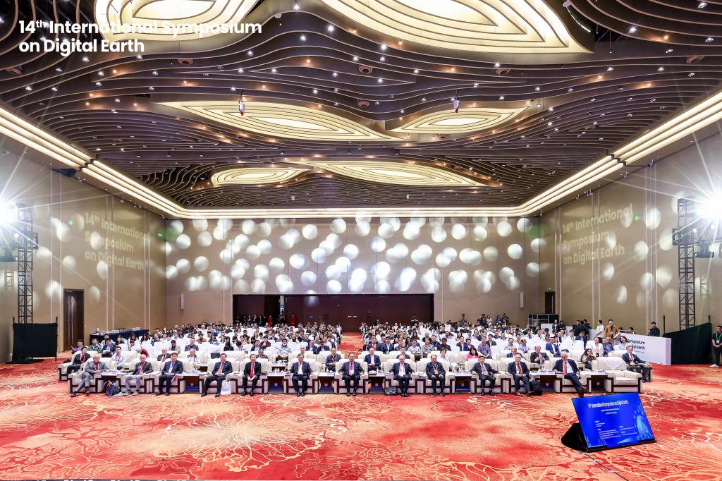
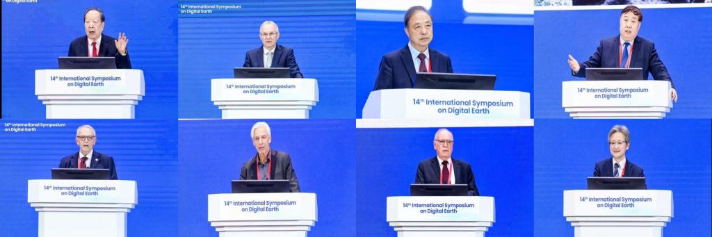
开幕式由中国科学院院士、国际数字地球学会名誉主席郭华东院士主持。重庆市人民政府副市长马震、联合国第77届大会主席Csaba Kőrösi、国际数字地球学会主席Alessandro Annoni、西南大学校长王进军、中国科学院国际合作局副局长王振宇等嘉宾分别致辞,表达了对数字地球理念赋能可持续发展的高度认可与美好期许。特邀报告环节,李德仁院士以“时空智能助推可持续发展目标”为题,介绍了PNTRC系统的集成创新与时空智能在灾害预警、资源监测等领域的关键应用。Csaba Kőrösi主席则围绕“面向2030的可持续转型挑战与数字解决方案”进行演讲,强调了科学认知、数据标准化与国家协同在加速SDGs实现中的作用。郭华东院士介绍了“地球大数据科学工程”与“可持续发展大数据国际研究中心”的阶段性成果,强调了开放共享与全球协作机制的重要性。随后,傅伯杰院士探讨了人地系统耦合与生态可持续性,Alessandro Annoni博士反思了数字地球发展中“缺失的环节”,呼吁以开放科学理念推动全球合作。Thomas Blaschke院士聚焦遥感与地理信息在环境报告与SDGs指标体系中的应用,David J. Coleman院士则探讨了数字地球时代对未来生活与工作的深远影响。最后,Hiromichi Fukui教授以日本区域空间规划为例,分享了数字地球平台支撑“区域循环共生圈”建设的实践经验。
重庆交通大学智慧城市学院共承办了5个专题分会场:官冬杰教授承担“Big Earth Data and Ecosystem Services”专题分会场,唐菲菲教授承担“Multi-Source Sensing for Urban Environment and Infrastructure”专题分会场,潘建平教授承担“Intelligent Extraction and Application of Sustainable Development Elements”专题分会场,姬翠翠副教授承担“Big Data in Support of LDN”和“Youth-Led Earth Observation Innovation: DBAR ICoE Ghana's Approach to Water-Energy-Land Nexus Management”两个分会场。
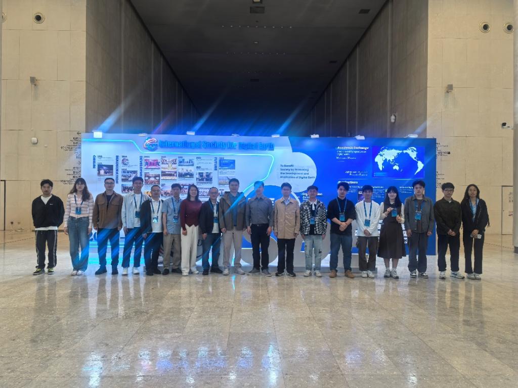
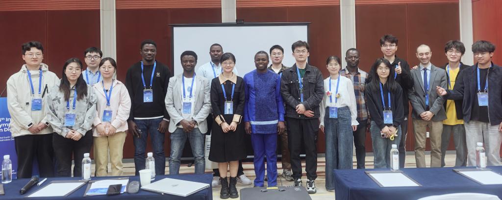
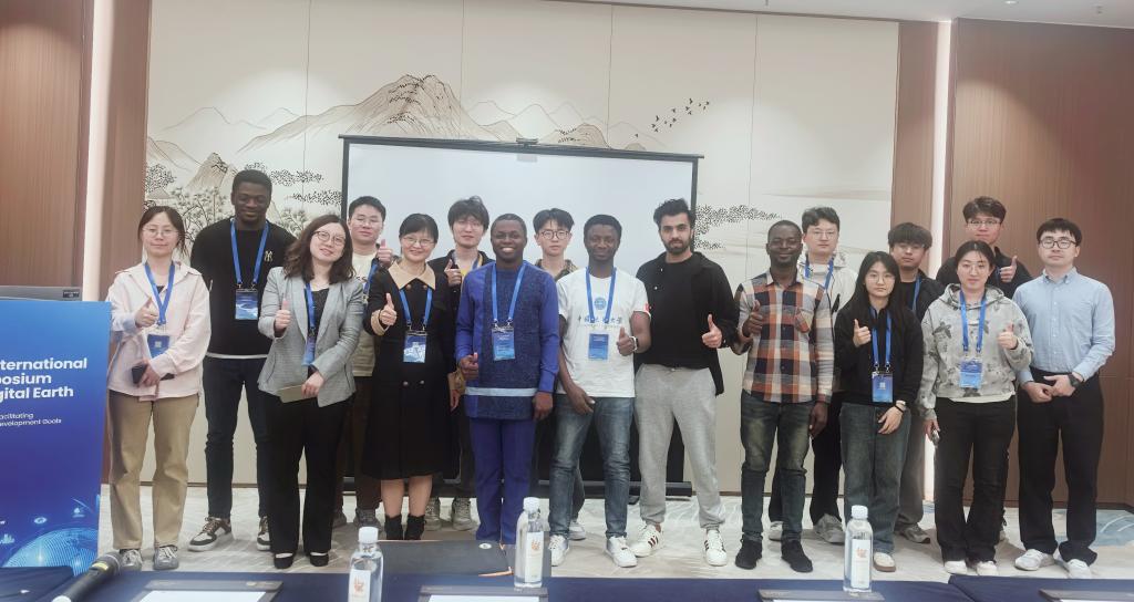
重庆交通大学智慧城市学院官冬杰、唐菲菲、马瑞金、潘建平、胡川、江利民、陈茂霖、姬翠翠、周李磊、杨志鑫、舒震等多位教师带领研究生参会。姬翠翠副教授分别作题为“Study on Sparse Non-photosynthetic Vegetation Fractional Cover Extraction using Svnergistie Spectral-Polarimetric Information”和“Spatiotemporal Dynamics of Photosynthetic and Non-photosynthetic Vegetation in the Arid and Semi-arid Regions of China”报告,杨志鑫老师作题为“LEO Constellation-enhanced Bps/GNSS Precise Point Positioning”报告,曹佳梦博士作题为“Seasonal Responses and Driving Factors of Extreme Streamflow in the Yangtze River Basin”报告。研究生徐渝杰、彭锦鸿、范誉文、殷瀚汶、叶代伟、石一彤、黄伟、张荧芷、程昌树、曲世乾、杨恒聪、月亮高可、肖天兰、张娜、崔豪分别作题为“Single tree extraction by combining forest structure characteristics with Sector-based KDE in TLS”、“Forestry Representation and Application of 3D Scene Graph Generated from LiDAR Point Cloud”、“Visual Quality Analysis of Indoor Viewpoints based on UAV and TLS Point Clouds”、“Improved TreeLearn Algorithm with Robust Tree Base Detection and Contextual Adaptation”、“Optimizing the Landscape Combination for Multifunctionality and Equity of Ecosystem Services”、“Construction and Application of a Carbon Emissions Estimation Model for China based on Gradient Boosting Algorithm”、“Spatiotemporal Evolution Patterns and Driving Forces of Ecosystem Services in the Chengdu-Chongqing Economic Circle: A Supply-Demand Perspective”、“Assessment and Forecasting of Water Resource Carrying Capacity in the Yangtze River Economic Belt under SSP-RCPs Scenarios”、“Research on Forest Fire Detection Using FY-4AAGRI Mid-Infrared Data”、“A Novelty Model for Estimating Leaf Moisture Content in Haloxylon ammodendron using Hyperspectral Data with Partial Least Squares Regression(PLSR)”、“ForestWildfire Risk Assessment of Anning River Valley in Sichuan Province based on Driving Factors with Multi-Source Data”、“Above-Ground Biomass Estimation of the Grain for Green Program Stands using UAV-LiDAR and Sentinel-2 Data withMachine Learning Algorithms”、“Estimating Fractional Cover of Photosynthetic and Non-photosynthetic Vegetation in the Arid and Semi-aridAreas of China”、“Forest Fire Risk Prediction and Assessment in Anning River Basin of Sichuan Province based on PCFRCNN Modeling”和“ Spatiotemporal Analysis of Land Degradation in the Three Gorges Reservoir Area from 1990 to 2020”的学术报告。
本次会议为全英文汇报,有来自世界各地的专家和学者。重庆交通大学智慧城市学院师生参加此次国际学术会议不仅拓展了学术视野、增强学术交流,锻炼了英语口语交流与汇报能力,促进了我院学生的对外学术交流,遵循了理论与实践并重的培养要求,拓宽了学生的国际视野。
国际数字地球会议作为国际数字地球学会主办的国际系列学术会议,首届会议于1999年在北京国际会议中心举办、2009年第六届会议落地中国北京以来,此次系第三次于我国境内举办。本次会议是学会成立二十周年之际,首次以数字地球理念创新与未来发展战略为专题的国际学术盛会,其召开对于凝聚全球智慧、推动数字地球领域跨学科协同发展具有重要战略价值。
(注:所有图片由主办方和参会教师提供)
【关闭】